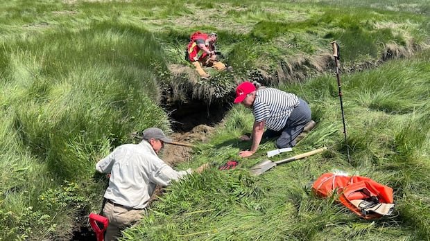
On a river in southwest Nova Scotia, a historical detective is currently investigating and revealing long-forgotten aspects of North America’s history.
The Allains River, previously known as the Lequille River, meanders as a tributary of the Annapolis River, flowing from Nova Scotia’s interior to Annapolis Royal. Around four centuries ago, this river housed one of the earliest industrial facilities established post-colonization: a flour mill constructed in 1607 and later destroyed by fire in 1643.
For many years, the exact whereabouts of this mill remained a mystery. However, an amateur historian from the United States, along with a team of researchers and archaeologists, is now making significant progress in pinpointing its location. This endeavor is illuminating the history of colonization, interactions, and the enduring Mi’kmaw presence in Nova Scotia.
Mark Borton, a writer from Connecticut, who spearheaded the search for the Poutrincourt gristmill, described it as a captivating puzzle to solve and emphasized its immense historical significance. The necessitation of a gristmill to produce flour arose in 1605, following the establishment of a fortified fur-trade post at Port Royal by Samuel de Champlain on the Annapolis Basin. Borton highlighted that bread constituted a significant portion of the French diet at the time.
The Poutrincourt gristmill, a water-driven grain grinding mill, was depicted on maps from that era, including Champlain’s map, which piqued Borton’s interest during his visit to the Maritimes in 2018. He recognized the mill’s importance as an early industrial power site in North America and embarked on a quest to identify its location.
Challenges in historical mapping accuracy plagued earlier attempts to locate the mill. Borton, however, believes the mill’s site may diverge significantly from existing historical theories. By overlaying elements from Champlain’s map onto present-day geographical features, Borton narrowed down a potential site. Subsequent investigations led him to identify what could be the mill’s foundation in a marshy area, further supported by the discovery of what appeared to be a man-made square structure using Google Maps.
Collaborating with the Nova Scotia Museum, Borton obtained the necessary permits to continue his exploration. His research also unveiled additional historic sites in the vicinity. Furthermore, by engaging archeologists from Kwilmu’kw Maw-klusuaqn and Saint Mary’s University, Borton’s efforts align with ongoing research on the French-Mi’kmaq interactions during this pivotal period.
The shared landscape of Allains River encapsulates a blend of European and Indigenous histories, representing a time of cooperation and negotiation. Fowler, a professor at Saint Mary’s, underscored the importance of this collaborative endeavor, emphasizing its potential to offer insights for the present and future. Ground-penetrating radar will be utilized to delve deeper into the mill site, aiming to uncover more hidden historical treasures along Allains River.